In the Kingdom of Saudi Arabia, landscape design is a harmonious blend of the ancient traditions that have built the country and the modern innovations that contribute to its growth. This feat of survival in the harsh desert climate is a testament to Saudi Arabia’s vision. As the nation undergoes a monumental transformation, mega development has become the standard. From the mirrored walls of NEOM to the heritage-steeped alleys of Diriyah, the scale is unprecedented.
But with grand scale comes grand risk. To navigate the intersection of ancient soul and futuristic ambition, BIM landscape design in Saudi Arabia has evolved from a luxury to a baseline necessity.
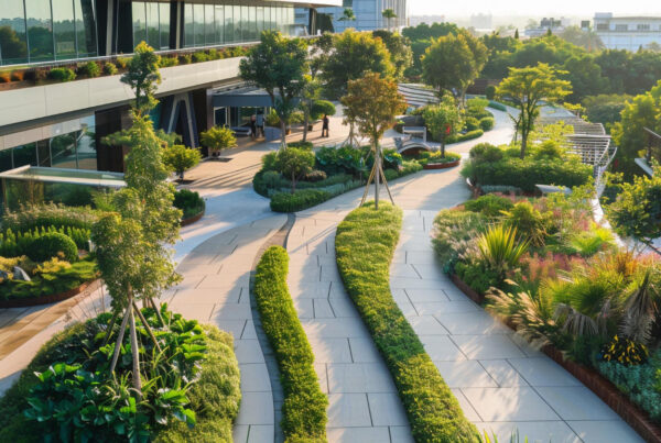
Saudi architecture is a poetic contradiction. It breathes through the heavy, cooling mudbrick of the Najd and the intricate Islamic gardens that offer a sensory escape from the heat. Yet, it simultaneously reaches for the sky with glass and steel. When you walk through these sites, you feel the dialogue between centuries.
Designing for these developments requires a deep respect for traditional materials. Landscaping looks to the coast for Coral Stone, used historically in Jeddah’s Al Balad to breathe with the sea. It looks to the volcanic fields for Harrat, a basalt rock that adds a raw, grounded texture to modern plazas. Even the fundamental textures of the Arabian desert, the specific grades of gravel and sand, are digitally cataloged to ensure the transition from the wild desert to the manicured park feels intentional and natural.
What is BIM?
In the world of mega developments, Building Information Modeling is much more than a 3D drawing tool. It is a data-rich process that allows us to build a digital twin of a project before the first stone is laid. While 3D modeling focuses on how a site looks, BIM focuses on how it works. It involves creating intelligent models where every tree, stone, and pipe contains embedded data regarding its cost, material properties, and maintenance schedule.
For landscape architecture in the Kingdom, this means we are no longer just sketching layouts. We are building a living database. In this context, BIM technology acts as the backbone of a development. It ensures that the landscape is not just a surface layer but a fully coordinated system that communicates with the buildings and utilities surrounding it. This is why integrated landscape engineering is the only way to manage the massive scale of modern Saudi projects without falling victim to unmanaged risks.
The Climate Challenge
The primary risk in any Saudi development is the environment. We are designing in a landscape of extremes, where the harsh climate is a physical force that can wither a project’s investment as quickly as it withers a poorly chosen sapling. If we do not account for the heat and the wind from day one, the project is destined for failure.
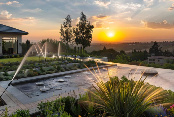
This is where xeriscaping becomes the hero. By utilizing native flora that has thrived for millennia, we mitigate the risk of plant failure and excessive water consumption. Our palette includes the iconic Date Palms, specifically the Khalas or Sukkari varieties, which we place strategically for maximum shade. We also rely on resilient giants like the Acacia, Sidr, and Ushar. For the ground level, we use desert groundcovers like Thama, Ghada, and Nama, which anchor the soil and require minimal hydration.
Infrastructure and Landscape Integration
In a mega development, the landscape sits atop a labyrinth of MEP (Mechanical, Electrical, and Plumbing) systems. The traditional risk is a siloed design, where the landscape architect and the utility engineer do not realize their designs occupy the same physical space until a backhoe hits a pipe.
This is where landscape clash detection becomes vital. By creating a digital twin, we identify where a tree’s future root zone might interfere with a high voltage line or where an irrigation main might conflict with a district cooling pipe. This infrastructure and landscape integration prevents the rip-and-replace cycles that can derail a project’s timeline and budget. In a Saudi mega project, identifying one major clash in the office rather than the field can save millions in rework.
Drones and 3D Modeling
The vast, shifting topography of Saudi Arabia, from jagged mountains to moving dunes, poses a massive logistical risk. Traditional surveying is too slow for the pace of Vision 2030 projects.
We use drones to capture high-definition topographical data, which is then fed into 3D landscape BIM solutions. This allows us to perform precise grading and site analysis. We can simulate exactly how much sand needs to be moved, reducing the risk of earthwork surprises that often cause massive budget overruns. Furthermore, we use these models to simulate wind patterns and solar heat gain, ensuring that a Nabatean-inspired plaza or a modern courtyard remains thermally comfortable for users throughout the year.
Why BIM Coordination is Necessary
The sheer density of BIM coordination in KSA projects means that guessing is the highest risk a developer can take. When we provide BIM consulting services in Saudi Arabia, we are providing a roadmap for the entire project lifecycle.
- Water Management
We use algorithms to ensure every drop of recycled greywater reaches the nursery or the park, honoring the Nabatean legacy of water conservation with modern precision. - Documentation
We produce precise engineering drawings and material submittals that ensure the civil and hardscape design is built exactly as intended, the first time. - Long-Term Maintenance
Because the data is embedded in the model, the risk of maintenance neglect is reduced. The facility managers know exactly when a water feature needs servicing or when a specific grove of Sidr trees requires pruning.
How the Landscape Company Integrates BIM into Design?
The landscape company weaponizes Building Information Modeling (BIM) to transmute ethereal concepts into high-fidelity, data-rich ecosystems. Leveraging BIM technology, the firm anchors every design decision in an intelligent 3D substrate, collapsing the distance between aesthetic intent and structural reality. This unified digital environment acts as a gravitational center for hardscape geometries, botanical layouts, and hydraulic systems, ensuring the visual narrative remains unshakeable from the first digital stroke to the final site inspection.
As the design matures, BIM functions as a predictive engine, calibrating topographic shifts and material lifecycles with surgical nuance. The team leverages this multidimensional clarity to rehearse the landscape’s performance, interrogating how porous surfaces interact with subterranean drainage or how light play animates a water feature at twilight. This rigorous analytical layer strips away guesswork, allowing the company to curate resilient environments where sustainability is a coded requirement rather than an afterthought.
The true zenith of this workflow is its interdisciplinary resonance. By hosting a live, synchronized model, the landscape company neutralizes spatial collisions between roots and conduits long before a shovel breaks the surface. This proactive synchronization with civil, structural, and MEP teams replaces reactive fixes with preemptive precision, delivering sophisticated outdoor realms that are as precisely engineered as they are organic.
Final Thoughts
In the desert, the margin for error is razor-thin. By embracing integrated landscape engineering and Landscape BIM services in Saudi Arabia, we turn a project’s biggest threats, the climate, the scale, and the technical complexity, into its greatest strengths.
We are not just designing spaces. We are using BIM to build a safety net around the client’s investment. As the Kingdom moves toward a future of smart, sustainable cities, integrated BIM-based design is the only way to ensure those visions become a reality without the risk of failure.
FAQs
- How does BIM landscape design Saudi Arabia reduce my project costs?
By using a digital twin, we identify potential conflicts between landscape elements and underground utilities before construction begins. This landscape clash detection prevents expensive rework, material waste, and site delays, ensuring your budget remains controlled throughout the project lifecycle. - Can BIM help in achieving sustainability certifications for mega developments?
Yes. Our 3D landscape BIM solutions allow us to simulate water consumption and thermal performance accurately. By optimizing xeriscaping and irrigation via integrated data, we help developers meet Saudi Vision 2030 sustainability goals and international environmental standards. - Why is integrated landscape engineering vital for KSA mega projects?
Mega projects involve thousands of moving parts. Our integrated landscape engineering approach ensures that civil, hardscape, and soft landscape designs are perfectly coordinated with MEP and structural teams. This unified workflow minimizes the risk of infrastructure failure in harsh desert conditions. - Does your BIM coordination KSA service include long-term maintenance data?
Absolutely. Every element in our models contains embedded data for material properties and maintenance schedules. This allows facility managers to know exactly when to service water features or prune specific species like Acacia or Sidr, reducing long-term operational risks. - How do you handle the logistics of massive planting palettes in BIM?
We use Landscape BIM services Saudi Arabia to catalog every plant type, from Date Palms to groundcovers like Nama. We track quantities, growth patterns, and water needs within the model, which streamlines the procurement and material submittal process for large-scale contractors. - Can drones and 3D modeling improve early-stage project feasibility?
Yes. We use drones to capture high-definition topographical data, allowing for precise earthwork calculations. This reduces the risk of budget overruns during the grading phase and provides developers with a clear, data-backed visualization of the project’s future outcome.