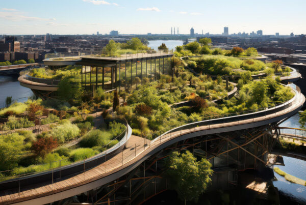


Large developments rarely fail because of a single design flaw. More often, it is water. A community, a mixed-use district, or a resort masterplan brings together buildings, roads, paving, planting beds, and open plazas, and every one of those elements changes how rainwater moves across the site.
This is why grading and drainage sit at the center of any large-scale design. Landscape grading shapes the ground so water moves where it should. Drainage infrastructure carries that water once it has been collected. Stormwater management decides how the runoff is held, conveyed, and eventually released, so the site performs the way it was designed to, season after season.
What Is Landscape Grading?
At its core, landscape grading is the shaping of ground levels to control how water behaves on a site. It involves setting slopes, elevations and contours so that rainfall moves away from buildings, hardscape and sensitive planting zones instead of pooling against them. On a small garden, this might mean a gentle slope away from a wall. On a large development, it means coordinating hundreds of elevation points across plazas, parking areas, roads, and green spaces so they all work as one connected surface.
What makes grading demanding at scale is that every zone influences the one next to it. A change in level at a plaza edge affects the swale beside it, which affects the planting bed downstream, which affects the storm line beneath the road. Grading, in this sense, is less about individual high and low points and more about designing a continuous, readable path for water from the moment it lands to the point it leaves the site.
How Landscape Grading and Drainage Work Together
Grading and drainage are often discussed as separate disciplines, but on the ground they function as one system. Grading determines the direction and speed at which water travels across a surface. Drainage infrastructure then takes over once that water reaches a defined collection point, whether that is a catch basin, a swale, or a permeable planting strip. Neither one works well without the other.
The grading plan tells you where water goes. The drainage plan tells you what happens to it once it gets there. When these two are developed side by side, from the earliest concept stage, the resulting system tends to be simpler, with fewer structures needed to correct problems that better grading could have avoided in the first place.
What Should Be Assessed Before Landscape Grading Begins?
Before a single contour line is drawn, the site itself has to be understood on its own terms. A grading plan built without this groundwork tends to react to problems later instead of preventing them.
Here is what typically needs to be assessed first.
-
Existing topography and site levels
A detailed topographic survey shows how the land currently slopes, where the high and low points sit, and how they relate to surrounding streets and neighboring parcels. This becomes the baseline against which every proposed level is measured.
-
Soil and ground conditions
Soil type affects how quickly water infiltrates the ground, how stable slopes will be, and whether certain drainage solutions, such as infiltration trenches, are even viable. Sandy soils behave very differently from compacted clay, particularly across a site the size of a large development.
-
Rainfall and catchment characteristics
Understanding local rainfall intensity, storm frequency, and the size of the catchment area feeds directly into how much water the site needs to manage. A short, intense downpour places very different demands on a system than steady rainfall spread over hours.
-
Existing drainage infrastructure
Any development connects, eventually, to a wider network of municipal storm lines, channels, or natural watercourses. Reviewing the capacity and condition of that existing infrastructure early prevents a well-designed site system from discharging into a line that cannot handle it. It also clarifies where connection points are actually available.
-
Buildings, roads, hardscape and landscape zones
The layout of built and paved areas determines where hard, impermeable surfaces concentrate runoff and where softer, planted zones can help absorb it. Reviewing this layout alongside the grading plan ensures that hardscape and landscape are not designed in isolation, but as parts of the same water management strategy.
Key Landscape Grading Considerations for Large Developments
Once the site has been assessed, the grading strategy itself has to address several recurring risks that show up on almost every large-scale project. Getting these right early avoids costly rework later.
Here are the considerations that matter most:
-
Establish clear drainage paths
Every part of the site should have an identifiable route for water to follow, from the point it lands to the point it leaves. Ambiguous or competing flow directions are one of the most common causes of ponding on large sites. A clear path also makes the system easier to maintain and troubleshoot later.
-
Protect buildings and critical infrastructure
Finished grades around building perimeters, transformers, and other critical assets need enough slope and clearance to keep water moving away, not toward them. Even a small design error here can lead to water infiltration issues that are expensive to fix after construction. This is usually one of the first checks in any grading review.
-
Coordinate finished levels between landscape and hardscape
Paving, kerbs, planting beds and structures all meet at edges, and those transitions need to align in level and intent. A landscape bed set slightly too high against a paved path can trap water instead of absorbing it. Coordinating these levels across disciplines avoids awkward, unintended barriers to flow.
-
Avoid isolated low points and unintended water pockets
Low points that are not part of the intended drainage design tend to collect standing water, which damages planting, invites pests, and stresses hardscape over time. These pockets often appear where different design zones meet without proper coordination. Reviewing the full grading model, not just individual areas, helps catch them before construction.
-
Control steep slopes and erosion
Slopes that are too steep for the soil type or planting strategy are prone to erosion, especially during intense rainfall. Grading needs to balance the practical need for slope with the long-term stability of the surface. Where steep grades are unavoidable, additional stabilization measures usually need to be built into the plan.
-
Preserve or work with natural drainage patterns
Sites often have existing natural drainage tendencies, shaped by original topography long before development began. Working with these patterns, rather than overriding them entirely, tends to produce systems that behave predictably under stress. Ignoring them frequently shifts problems elsewhere on or beyond the site.
-
Allow sufficient access for inspection and maintenance
A drainage system that cannot be reached for cleaning or repair will eventually fail, regardless of how well it was designed. Grading plans need to account for access points, clearances around structures, and space for equipment. This consideration is easy to overlook early on and expensive to retrofit later.
Landscape Drainage Systems for Large Developments
Large developments rarely rely on a single drainage method. Instead, they combine several systems, each suited to a different part of the site and a different type of water flow.
Here is how these systems typically break down.
-
Surface drainage systems
Surface systems, such as graded swales, channels, and sloped hardscape, move water across the visible surface toward a collection point. They are often the first line of defense because they are simple, visible, and relatively easy to maintain.
-
Conveyance systems
Once water is collected, conveyance systems such as underground pipes, catch basins, and culverts carry it toward its final discharge point or storage area. These systems need to be sized correctly for peak flow, not just average conditions, or they become a bottleneck during heavy rainfall.
-
Green infrastructure and landscape-based drainage
Bioswales, permeable paving, rain gardens and planted retention areas allow water to infiltrate or be temporarily stored within the landscape itself, reducing the load on conveyance systems. Beyond their drainage function, these features also support planting health and reduce the visual dominance of purely engineered drainage elements.
Stormwater Management for Large Developments
Stormwater management looks beyond individual grading and drainage decisions to how the entire site handles water at scale, particularly during heavy or prolonged rainfall. It covers how runoff is retained on site, how it is conveyed through the network of surface and underground systems, and how it is eventually discharged, whether into a municipal system, a natural watercourse, or an on-site retention feature.
For large developments, this usually means designing for peak events rather than average conditions, since it is the extreme storms, not the typical ones, that reveal weaknesses in a system. Detention basins, attenuation tanks, and phased release strategies all serve the same underlying goal: slowing water down enough that downstream infrastructure, whether on site or beyond it, is never asked to handle more than it can manage at once.
Drainage Design Considerations in Saudi Arabia
The drainage design in Saudi Arabia carries its own set of demands, shaped largely by climate and the pace of development. Rainfall here tends to be infrequent but intense, arriving in short, heavy bursts rather than steady seasonal patterns. This means systems designed around average annual rainfall figures often underperform badly during the storms that actually matter, which is why flash flood analysis and return period modeling are treated as standard practice rather than an added step on major projects.
On giga-projects and large mixed-use developments across the Kingdom, drainage is frequently designed into the masterplan from the outset, with underground attenuation and at-source detention built in as core infrastructure rather than a later addition. For any large development in the region, this shift means grading and drainage decisions need to be made early, with enough technical rigor to satisfy both engineering performance and regulatory approval.
How Grading and Drainage Should Be Coordinated During Project Delivery
Coordinating grading and drainage is not a one-time task that happens at the start of design and then gets locked in. On a large development, levels shift as architectural, civil and landscape drawings evolve, and a grading plan needs to be revisited each time one of those disciplines changes something that affects the ground.
The most reliable way to manage this is through regular coordination between landscape architects, civil engineers and the wider design team, checked against a shared model rather than separate drawings. When finished floor levels, road profiles and landscape grades are reviewed together at each design stage, discrepancies get caught while they are still easy to fix. Left until construction, the same discrepancies tend to surface as standing water, blocked drains or awkward level changes that no one intended.
Common Landscape Grading and Drainage Mistakes
Most drainage problems on large developments trace back to a handful of recurring mistakes, many of which are avoidable with earlier coordination. Recognizing them helps teams catch issues before they become expensive to fix.
Here are the ones we see most often.
-
Designing grading before understanding existing water movement
Grading that ignores how the site already drains tends to fight the land rather than work with it. This usually surfaces later as unexpected ponding or erosion in areas that seemed fine on paper.
-
Treating the landscape as separate from civil infrastructure
When landscape grading is finalized without close reference to civil drainage drawings, the two systems can end up working against each other. Coordination gaps like this are often the root cause of drainage complaints after handover.
-
Relying on a generic slope percentage
A flat 2% rule gets applied to sites regardless of soil type, rainfall intensity, or surface material, as though one number could suit every condition. The right slope depends on context, and treating it as universal is one of the more persistent mistakes in the industry.
-
Creating low points without a defined drainage solution
Low areas are sometimes left in a design without a clear plan for what happens to the water that collects there. Without a defined outlet or storage function, these points become long-term maintenance problems.
-
Ignoring downstream drainage capacity
A well-designed on-site system can still fail if it discharges into a downstream line or channel that cannot handle the added flow. This is why reviewing existing infrastructure capacity has to happen before, not after, the site design is finalized.
-
Altering natural drainage paths without assessing consequences
Redirecting a natural flow path to suit a layout can shift flooding risk elsewhere on or beyond the site. These consequences are not always visible immediately, which makes them easy to overlook during design.
How to Design a Landscape Grading and Drainage Strategy That Performs Long-Term
A strategy built for the long term looks different from one built simply to pass initial review. It accounts for how the site will behave years after handover, not just how it performs on the day it opens.
Here is what that approach generally involves.
-
Start with the site’s existing hydrology
Understanding how water already moves across the land, before any design work begins, gives the grading strategy a realistic foundation. Plans built on this understanding tend to require fewer corrective measures later. It also reduces the risk of unintended consequences on neighboring land.
-
Coordinate landscape, civil, and infrastructure design early
Bringing these disciplines together from the concept stage, rather than reconciling their drawings later, catches conflicts while they are still inexpensive to resolve. This coordination becomes more valuable, not less, as project scale increases. It is often the single biggest factor separating systems that perform well from those that need constant adjustment.
-
Select drainage systems according to site conditions
Choosing surface, conveyance or green infrastructure solutions based on actual soil, rainfall and land use conditions produces a system suited to the site rather than a generic template applied to it. This tailored approach also tends to reduce long-term maintenance demands. What works on a coastal development rarely transfers directly to an inland one.
-
Build maintenance requirements into the design
A system that cannot be easily inspected, cleaned or repaired will degrade faster than its design intended, regardless of how well it was engineered. Considering access, materials and inspection points from the outset extends the working life of the entire system. This step is frequently underweighted relative to its long-term impact.
Why Professional Landscape Grading and Drainage Planning Matters
Large developments carry too much complexity, and too much financial exposure, for grading and drainage to be treated as a formality. Getting these systems right protects buildings, extends the life of hardscape and planting, and reduces the maintenance burden that falls on whoever operates the site once it is complete.
Professional planning brings together the site data, engineering judgment and cross-discipline coordination needed to anticipate problems before construction, rather than responding to them after the fact. On a project of any scale, that difference tends to show up for decades, not just in the first rainy season.
Conclusion
Water does not follow a masterplan. It follows gravity, gradient and whatever path a site’s grading and drainage systems give it, which is why these decisions deserve attention from the earliest stages of design rather than as a technical formality applied near the end. On large developments, where the margin for error multiplies across buildings, roads and open spaces, that attention pays for itself many times over.
At The Landscape Company, we approach grading and drainage as part of the broader design conversation, not a separate technical exercise handed off once the layout is settled. Whether the project sits in a dense urban district or along a coastline shaped by seasonal rainfall, the goal remains the same: a landscape that manages water quietly and reliably, so the rest of the design can be enjoyed exactly as intended.
FAQs
- What is landscape grading?
Landscape grading is the shaping of ground levels and slopes to control how water moves across a site. It ensures runoff flows away from buildings and toward intended drainage points.
- Why is landscape grading important for drainage?
Grading determines the direction and speed of surface water before it ever reaches a drainage system. Without correct grading, even well-designed drainage infrastructure can fail to perform.
- What is the difference between landscape grading and drainage?
Grading shapes the land to direct where water flows, while drainage infrastructure collects and carries that water once it arrives. They are designed together, but they perform different functions.
- What drainage systems are used in large landscapes?
Large developments typically combine surface systems like swales, conveyance systems like pipes and catch basins, and green infrastructure such as bioswales and permeable paving. The mix depends on site conditions and rainfall patterns.
- What slope is required for landscape grading?
There is no single slope that fits every site. The right gradient depends on soil type, rainfall intensity, surface material and proximity to structures, which is why grading plans are developed around actual site conditions rather than one fixed figure.
- How is stormwater managed in large developments?
Stormwater management combines retention, conveyance and controlled discharge, usually designed around peak rainfall events rather than average conditions. Detention basins and phased release strategies help prevent downstream systems from being overwhelmed.
- Why is drainage design important in Saudi Arabia?
Rainfall in Saudi Arabia tends to be infrequent but intense, which places heavy demands on drainage systems during short periods. Combined with rapid urban development and evolving regulatory requirements, this makes early and rigorous drainage design essential for large projects.